
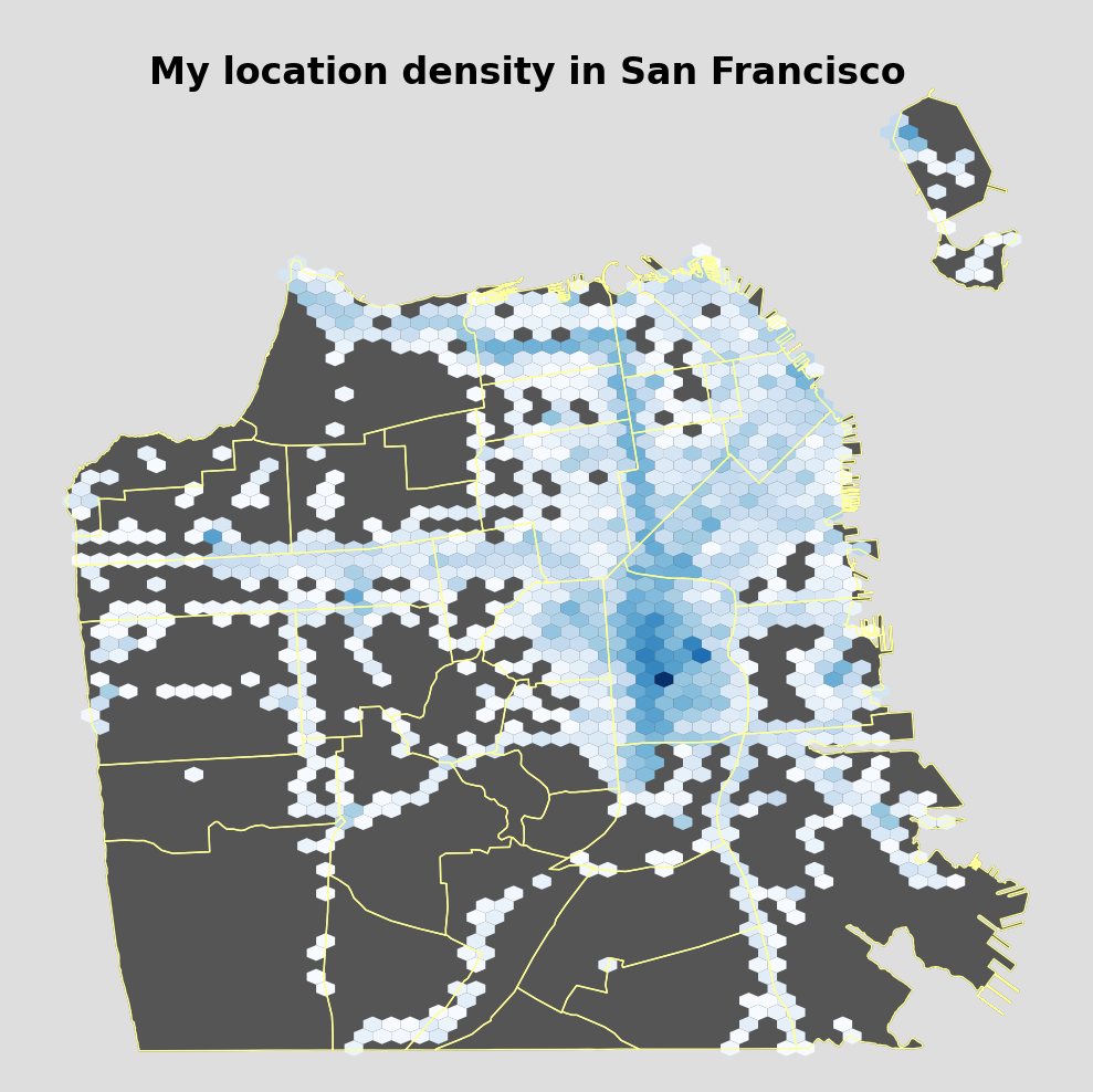
While I was researching more ways to visualize my Google Location History, I ran across Beneath the Data’s excellent post on exactly that. I thought I’d start with trying to replicate what Tyler had done (because his figures are way prettier than the ones I’ve made thus far), and then doing my own thing from there. Little did I know that this would send me down some giant GIS/shapefile/geography rabbit hole.
I have to be honest, my main takeaway from the Beneath the Data post was that you could download shapefiles and use those to make your figures instead of the default world stuff from Basemap that I had been using. I’ll also admit that, until this point, I thought the Basemap’s drawmapboundary(), drawcoastlines(), drawcountries(), etc were super cool. Not as cool as using some super detailed and specific shapefile, though!
I immediately went to download a bunch of shapefiles of San Francisco, California, etc. I got obsessed with Shapefiles. I saw a bunch used for ecological studies of the bay, but (though I was sorely tempted) I did not download those. Unfortunately, this is where I hit my first snag. Apparently, Seattle uploads shapefiles with WGS84 coordinates. San Francisco, alas, does not. Anywhere. Ever.
There is a boundless sea of vector files available for SF, but no WGS84 coordinates to be had. I researched for an embarrassing number of hours of how to convert to WGS84 and trying to figure out if they were calculations I could automate, and how exactly the x,y coordinates for shapefile vectors were calculated. I even installed QGIS because somebody said that you could save a layer as WGS84 through there. Well, I couldn’t get that to work. Maybe it is due to my inexperience with GIS and shapefiles, or maybe it is a function that QGIS doesn’t have anymore. I don’t know.
Finally, I found out that gdal has a super easy way to convert shapefiles to GeoJSON. It is literally just one command. PHEW. At last, I could download any Shapefile I wanted, and instantly convert them to get WGS84 coordinates if they didn’t already have them. I went with this San Francisco Zip Codes shapefile, and converted that.
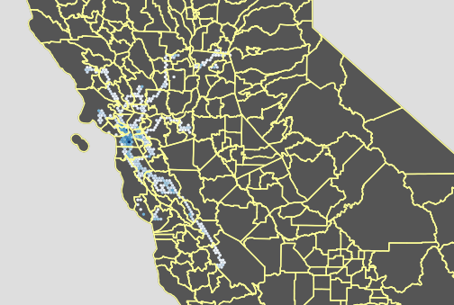
Of course, immediately after I figured out that gdal has this functionality, I found a California County shapefile that already had it in WGS84 coordinates, no conversion necessary. ISN’T THAT ALWAYS THE WAY.
Anyhow, I spent so much time learning about maps and shapefiles, that I haven’t yet done anything beyond simply replicating what Tyler did, but with my own data. But now that I’ve gotten all that out of the way, making the visualizations that I want will be the next step.
My older post Google Location History Part II can be read here.